
Tanzania Africa: Why This Country Is the Continent’s Premier Safari Destination
The East African landscape spans 945,087 square kilometers, defining the region’s largest protected terrain. This nation maintains 28 percent of its surface under conservation, much of it run by Tanzania National Parks, a commitment totaling over 250,000 square kilometers. Such scale provides stable ecosystems for 150,000 wildebeest and the legendary Big Five.

Geological diversity anchors the experience, from the Great Rift Valley to the 5,895-meter summit of Kilimanjaro. Political stability since 1961 ensures that infrastructure remains reliable across various elevations. Historical records show the first game reserve appeared in 1896, establishing a conservation framework decades before neighboring territories.
Today, the tanzania africa intersection unites Congo Basin forests with southern woodlands. Our operations manage logistics from sea level to the 2,286-meter Ngorongoro Crater rim. For specific inquiries regarding these terrains, contact us at +255 764 060 268 to speak with a field expert.
Key Takeaways
- Conservation efforts cover 28 percent of the total landmass.
- Ecosystems support over 150,000 wildebeest and stable Big Five populations.
- The terrain includes the 5,895-meter volcanic formation of Kilimanjaro.
- Formal conservation frameworks in the region date back to 1896.
- Continuous political stability since 1961 protects long-term conservation investments.
- Safari operations span diverse elevations, including the 2,286-meter Ngorongoro rim.
What Makes Tanzania Africa's Ultimate Safari Haven
The distinction of Tanzania’s landscape lies in its ability to support massive migratory herds alongside permanent, high-density predator populations. This geological foundation ensures stable habitats for iconic species across the Great Rift Valley. Conservation efforts manage over 25 percent of the land, preserving unfragmented ecosystems. These protected regions allow for natural biological processes to occur on a scale rarely documented in other parts of the continent.
The Big Five and Beyond
The Big Five designation—lion, leopard, elephant, buffalo, and rhinoceros—originated from historical hunting terminology. Today, it serves as a modern benchmark for ecological health. Tanzania successfully maintains these populations across seven separate protected areas, demonstrating a robust commitment to habitat preservation.
The Serengeti ecosystem currently supports approximately 3,000 lions. This represents the largest contiguous population of the species in Africa. Furthermore, the Ngorongoro Crater maintains a black rhinoceros density of one animal per 2.5 square kilometers. This is the highest recorded concentration on the continent.
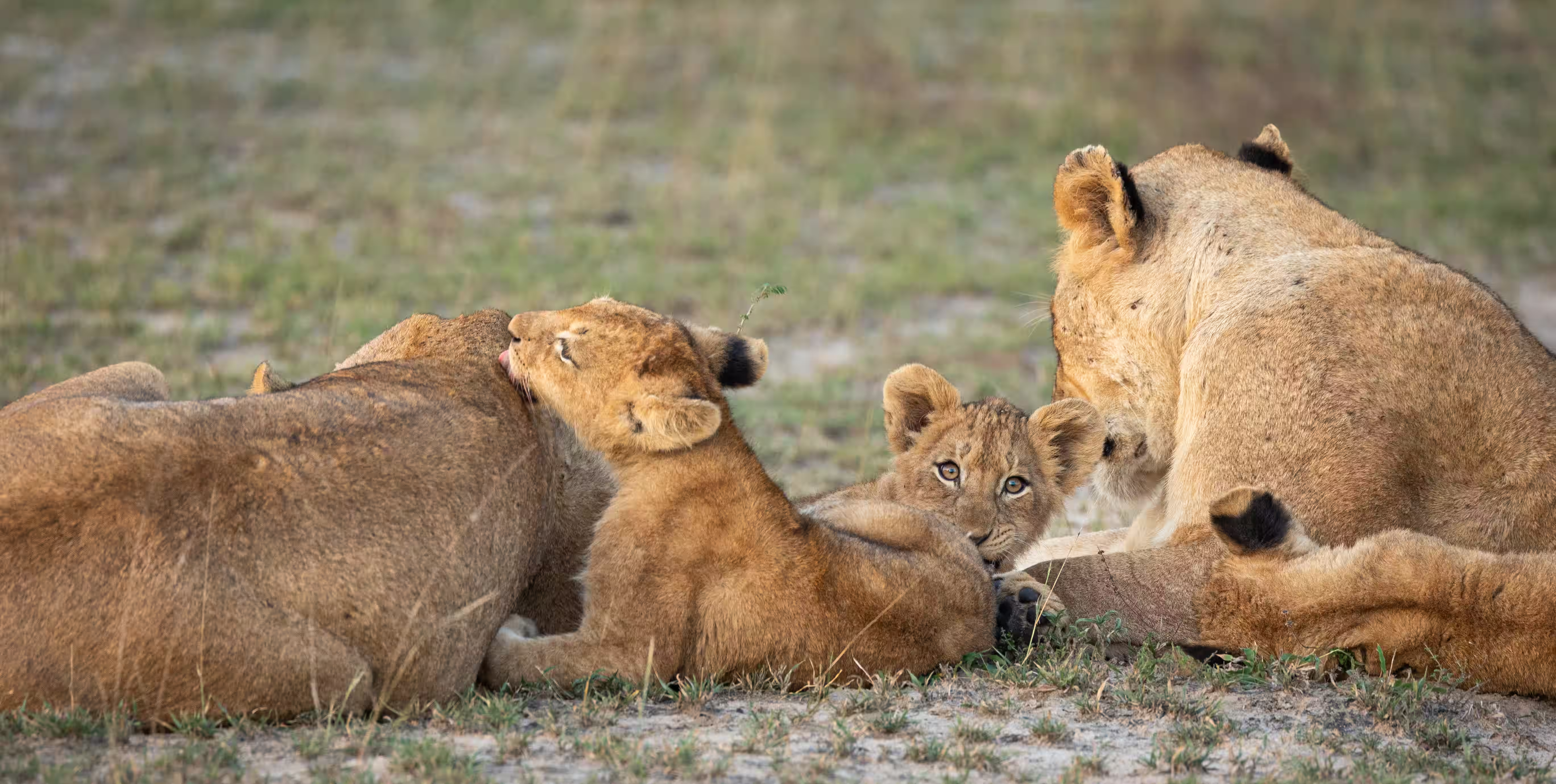
Adaptability defines the leopard population, which ranges from lowland riverine forests to highland escarpments at 2,800 meters. Massive herds also characterize the landscape. In Katavi National Park, buffalo numbers can exceed 50,000 individuals within a single gathering.
“The survival of our wildlife is a matter of grave concern to all of us in Africa. These wild creatures and the wild places they inhabit are not only important as a source of wonder and inspiration but are an integral part of our natural resources.”
Beyond the standard icons, the country harbors diverse biological assets. The Ruaha-Rungwa ecosystem sustains 60,000 elephants. Additionally, Tanzania holds 80 percent of Africa’s remaining wild dog population and 430 distinct bird species.
Year-Round Wildlife Viewing Opportunities
Wildlife viewing operates on two distinct seasonal patterns dictated by rainfall. The wet season, occurring from November to May, brings calving periods and concentrated predator activity. The dry season, from June to October, forces animals to congregate around permanent water sources.
| Region | Key Species | Notable Statistic |
|---|---|---|
| Serengeti | Lion | 3,000 individuals |
| Ngorongoro | Black Rhino | 1 per 2.5 sq km |
| Katavi | Buffalo | 50,000+ per herd |
| Ruaha | Elephant | 60,000 individuals |
The Great Migration follows a 1,200-kilometer circular route through the Serengeti. Approximately 70 percent of this annual cycle occurs on Tanzanian territory. Predictable movement patterns allow for precise tracking throughout the year.
Wildebeest calve in the southern Serengeti plains during February and March. By June and July, the herds cross the Grumeti River. They return south through the western corridor by November to begin the cycle again.
Geographic diversity supports these movements across varied habitats. Grassland plains host high herbivore concentrations. Acacia woodlands provide cover for ambush predators, while riverine forests serve as critical primate habitats.
World-Famous National Parks and Protected Areas
Tanzania’s conservation model relies on vast, interconnected landscapes that preserve prehistoric migration routes. These regions represent complex geological and biological systems that sustain thousands of species. Travelers seeking authentic experiences often search for Tanzania safari packages that provide access to these legendary terrains. By protecting these areas, the nation ensures the survival of the largest terrestrial mammal migration on Earth.
Serengeti National Park
Serengeti National Park encompasses 14,763 square kilometers of continuous ecosystem. Tanzania gazetted the park in 1951 to protect its unique biodiversity. The United Nations designated it a UNESCO World Heritage site in 1981.
The name derives from the Maasai word siringet, which translates to “endless plains.” These short-grass plains extend 100 kilometers across the southern sector. Annual rainfall varies from 500 millimeters in the southeast to 1,200 millimeters in the northwestern woodlands.
This variation creates distinct vegetation communities that support different wildlife assemblages. The park contains an estimated 1.5 million wildebeest and 250,000 zebra. It also supports 300,000 Thomson’s gazelle, forming the largest terrestrial mammal migration on the planet.
Granite rock formations known as kopjes rise 20 to 100 meters above the surrounding plains. These formations provide vital den sites for lions and leopards. They also create microclimates that support 30 endemic plant species.
The park maintains seven ranger posts to monitor the vast landscape. Twenty-six anti-poaching units operate across defined sectors to ensure safety. Patrol routes cover approximately 400 kilometers every week to maintain ecological integrity.
Ngorongoro Crater
The Ngorongoro Crater formed 2.5 million years ago when a massive volcanic cone collapsed inward. This event created a caldera measuring 19 kilometers in diameter. The floor area covers 264 square kilometers of nutrient-rich soil.
The crater rim stands at an elevation of 2,286 meters. A 600-meter escarpment drops down to the floor at 1,800 meters. This steep wall functions as a natural enclosure for resident wildlife populations.
Ngorongoro supports approximately 25,000 large mammals in permanent residence. This includes Africa’s densest lion population, which counts between 60 and 70 individuals. The crater also provides a sanctuary for 30 rare black rhinoceros.
The Lerai Forest covers 50 hectares of the crater floor. It consists mainly of yellow fever trees that provide essential browse for elephants. Buffaloes frequently use this forest for shade during the midday heat.
Lake Magadi is a shallow alkaline lake that covers one-third of the floor during the wet season. It attracts flamingo populations exceeding 20,000 individuals. The lake also provides necessary mineral licks for various herbivores.
The Ngorongoro Conservation Area operates under a unique multiple-use designation. This allows Maasai pastoralism to exist alongside wildlife conservation. This management style covers a total area of 8,292 square kilometers.
The Historical Roots of Tanzania's Conservation Success
The historical trajectory of Tanzanian conservation reflects a deliberate transition from colonial game management to national heritage preservation. This evolution began in 1896 when the German colonial administration established the Selous Game Reserve.
This action created Africa’s first large-scale protected area, spanning 50,000 square kilometers in southern Tanzania. It set a precedent for territorial boundaries dedicated specifically to the landscape and its resident species.
British Mandate authorities later expanded these efforts by designating the Serengeti as a partial game reserve in 1929. They elevated it to a full game reserve in 1940 to address the sharp decline in wildlife populations caused by unregulated hunting.
Data-driven management became a priority during the mid-twentieth century. The Fauna Preservation Society conducted the first systematic census in the Serengeti between 1956 and 1957.
This study documented exactly 99,481 wildebeest. These findings established the baseline data necessary for all future conservation planning and migration tracking.
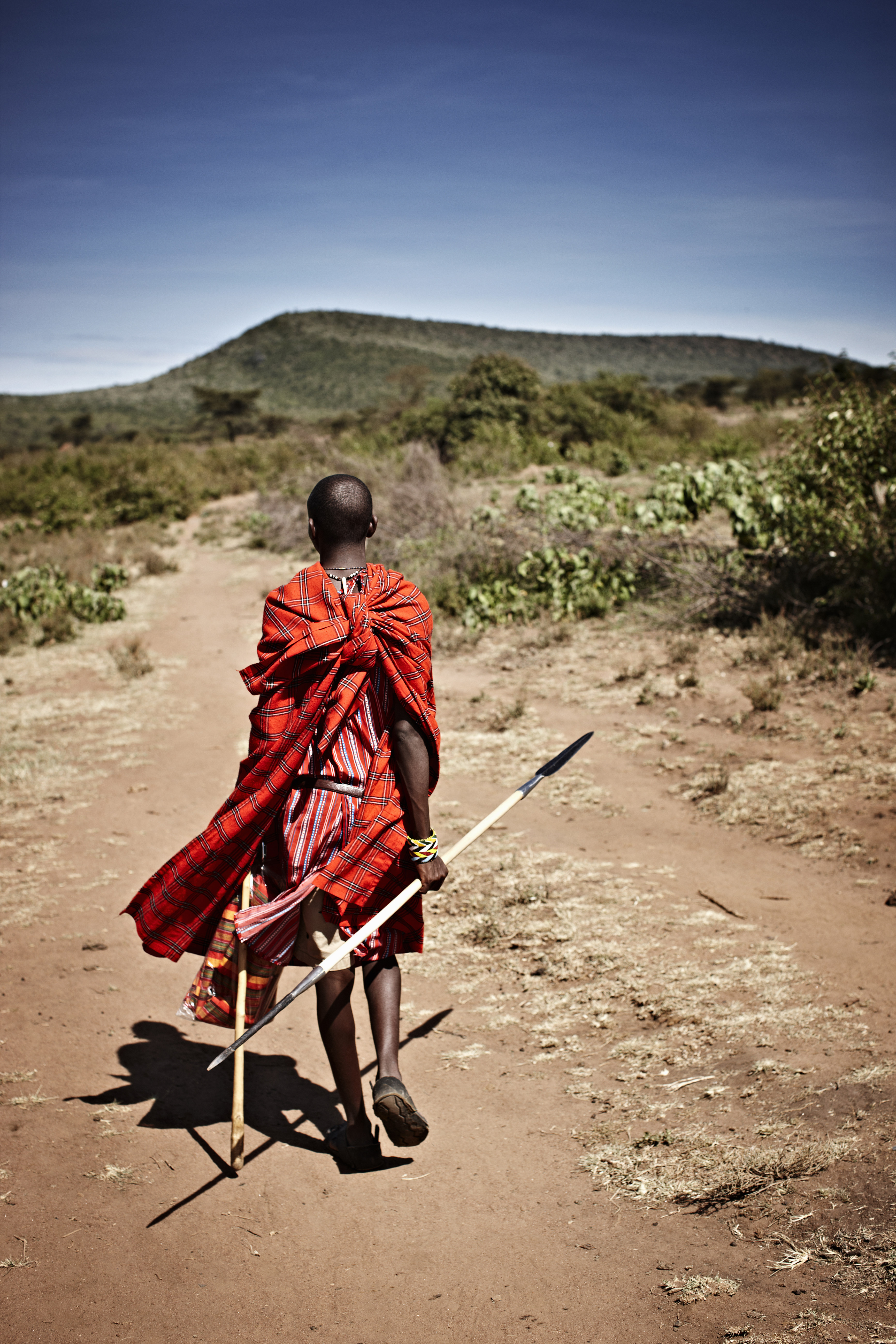
In 1959, the independence government under Julius Nyerere enacted the National Parks Ordinance. This legal framework elevated environmental protection to a national priority, placing it alongside economic development.
The country also established the Tanzania National Parks Authority (TANAPA) that same year. This autonomous body separated daily operations from general government administration to ensure professional management.
The Arusha Manifesto of 1961 solidified this commitment to the land and its resources. It remains the guiding document for the nation’s ecological ethics today.
“The survival of our wildlife is a matter of grave concern to all of us in Africa. These wild creatures amid the wild places they inhabit are not only important as a source of wonder and inspiration but are an integral part of our natural resources and our future livelihood and well-being.”
During the 1960s and 1970s, Tanzania invested 18 percent of its national budget into infrastructure. This funding built ranger stations, research facilities, and access roads across the newly designated parks.
Anti-poaching initiatives launched in 1989 showed the power of coordinated patrol systems and judicial enforcement. These efforts reduced elephant poaching by 85 percent within only five years.
In the 1990s, the focus shifted toward community conservation. The government began allocating 50 percent of park entrance fees to adjacent villages to create local economic incentives for protection.
| Era/Year | Legislative Milestone | Primary Achievement |
|---|---|---|
| 1896 | Selous Game Reserve | Established Africa’s first large-scale protected area. |
| 1959 | National Parks Ordinance | Created TANAPA and gave conservation legal priority. |
| 1961 | Arusha Manifesto | Declared wildlife as an integral part of national heritage. |
| 1989 | Anti-Poaching Operation | Reduced illegal elephant hunting by 85% in five years. |
| 1990s | Community Programs | Directed 50% of entrance fees to local village development. |
Conclusion
Documented conservation history and a vast protected landscape define Tanzania’s standing as a leading safari location. The country holds its rank through 250,000 square kilometers of protected land. This stable environment supports the Big Five and varied habitats across the volcanic hills.
Call +255 764 060 268 for facts on safari protocols and geological terrain. Our team offers direct insight into this unique and documented wilderness. We prioritize precision and land mastery for every visitor.
FAQ
What defines the scale of protected land in the region?
The nation maintains 28 percent of its 945,087 square kilometers under conservation status. This represents over 250,000 square kilometers of secured ecosystems. It stands as the largest destination by protected area on the continent of africa. For precise inquiries regarding the terrain, call +255 764 060 268.
Which species constitute the Big Five in these parks?
The group includes the lion, leopard, elephant, buffalo, and rhinoceros. Tanzania hosts all five across seven distinct protected areas. The Serengeti holds 3,000 lions, while the Ngorongoro Crater provides a refuge for black rhinos. Katavi National Park supports buffalo herds exceeding 50,000 animals.
How does the Great Migration move through the Serengeti?
The movement follows a 1,200-kilometer loop driven by rainfall. Wildebeest calve in the southern plains during February. The herds move toward the Grumeti River by June. They traverse the western corridor to return south in November. This cycle ensures the survival of 1.5 million wildebeest and 250,000 zebra.
What geological features define the Serengeti plains?
The name originates from the Swahili word siringet, which translates to endless plains. Granite rock formations called kopjes rise up to 100 meters above the grass. These formations provide essential den sites for predators. The ecosystem supports the world’s largest mammal movement across 14,763 square kilometers of land.
What specific measurements define the Ngorongoro Crater?
This caldera formed 2.5 million years ago after a volcanic peak collapsed. It measures 19 kilometers in diameter and covers 264 square kilometers. The rim sits at an elevation of 2,286 meters. This creates a 600-meter wall that acts as a natural enclosure. The Lerai Forest on the floor provides habitat for elephants.
What legal framework protects the national wildlife heritage?
The Arusha Manifesto of 1961 established the moral and economic value of conservation. The National Parks Ordinance of 1959 created the management body known as TANAPA. These laws ensure that a portion of park fees support local villages. For technical information on ground-level operations, call +255 764 060 268.
How does the Great Rift Valley influence the mining heritage and geology?
The Great Rift Valley system created diverse ecological zones across the eastern territory. Volcanic formations reach heights of 5,895 meters at Kilimanjaro. This geological history includes unique mineral deposits and varied soil types. The land reflects a deep mining heritage linked to the unique rock formations found in the southern highlands.